
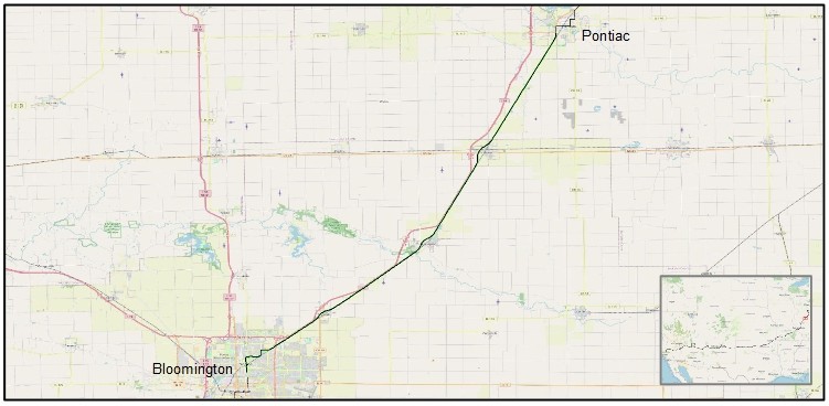
Pontiac, Illinois to Bloomington, Illinois

Very windy today. Pedaling into a relentless southwest wind made for a very long day today. Almost 8 hours in the saddle. Thankfully, I don’t have any saddle sores, but I do have a sore butt. I mean, my poor butt bones can only take so much. So, by late morning I began to stop more often – to take a photo, to check the map or take a look around, to walk a short way and use some other muscles in my leg. But mainly, just to get off the bike seat and relieve the pressure.
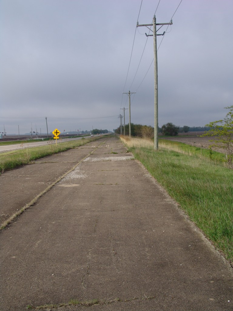
I learned a lot about Illinois’s US 66 today. I learned that the original 1926 alignment was just two very narrow lanes that ran through towns. And that by the mid-40’s it had widened to four lanes and was realigned to become a divided highway that bypassed town centers and residential areas. Later, when US 66 was decommissioned in the mid-1980’s, the two southbound lanes were closed and the two northbound lanes became Historic Route 66 – the two lane highway that now parallels Interstate 55. So to ride US 66 is ride on weed-strewn concrete slabs, or little-used town roads, or ever a well-maintained modern two-lane highway, and anything in between. It’s a ribbon of concrete that changed and evolved over the past one hundred years. And, for me, it’s not all that easy to trace. So I just follow a line on a map called Adventure Cycling Association’s Bicycle Route 66 and let the Route 66 aficionados wade through the finer details.
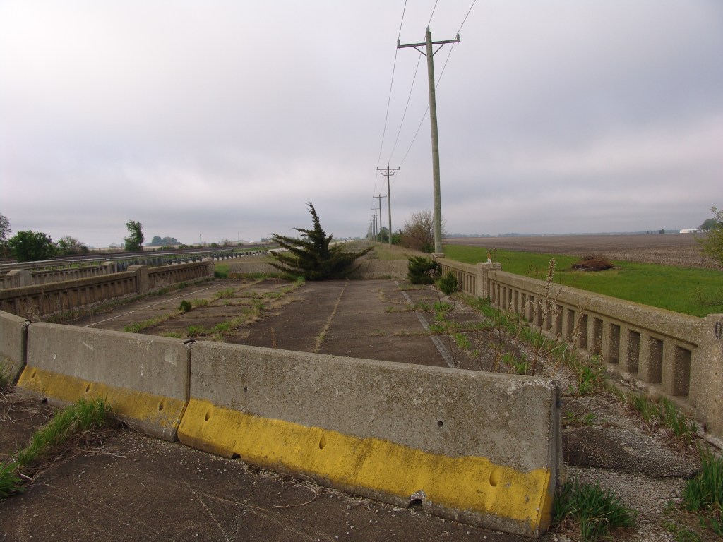
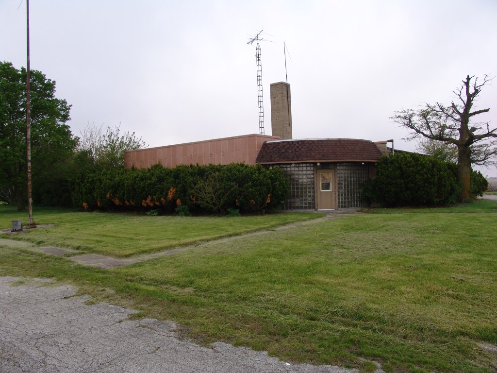
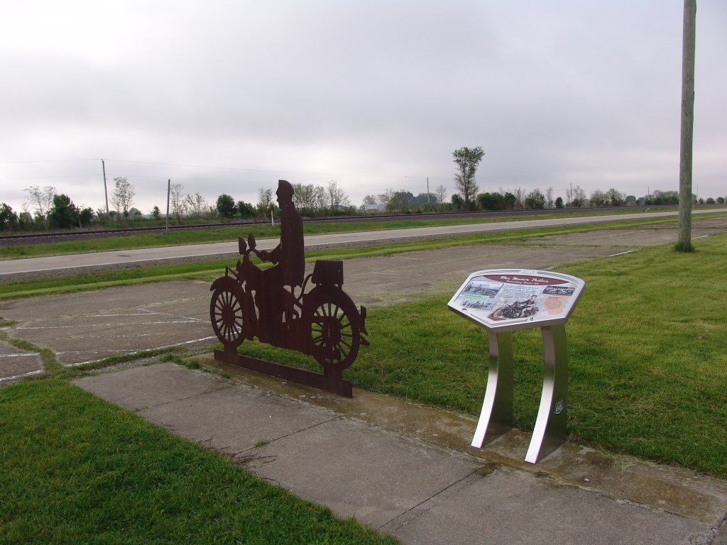
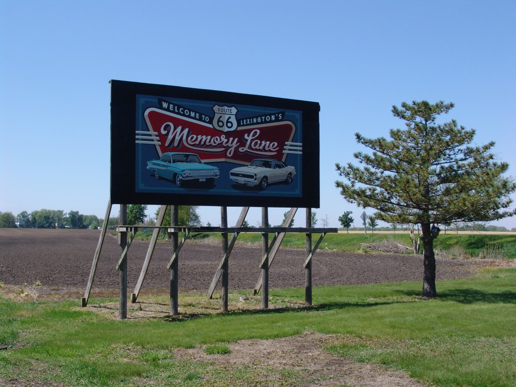
I rode past some of those details today. Like a couple bridges left over from the 1940’s southbound lanes’ alignment. And the old, abandoned State Police Headquarters for the district. And a ¾ mile length of the original 1926 alignment through Lexington called “Memory Lane. ” And miles-long bike paths built on top of an abandoned ribbon of concrete in Towanda. And more harrowing, on miles and miles of a heavily trafficked two-lane highway with no shoulder (aka Historic Route 66.)
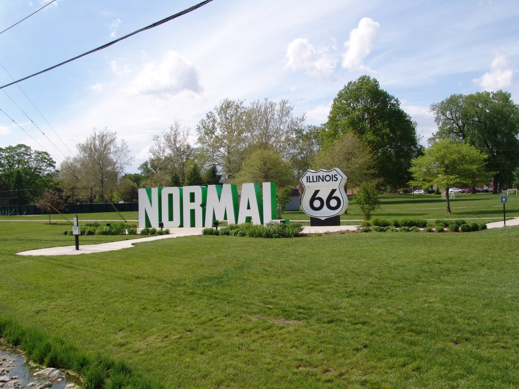
It was the traffic on Historic Route 66 that sent me off my planned route. Sharing the road with traffic is one thing. Riding on the edge of the pavement while a continuous string of vehicles zooms past less than 10 feet away at 70 mph is another. So somewhere between Lexington and Towanda I departed my planned route and took to the quieter farm roads. The short detour added a couple miles to my day but made the ride along that stretch much less nerve-wracking. Once I made it into Towanda, I rode a bike path all the way into Normal and to near my motel in Bloomington. The motel isn’t the Ritz, but it has a hot shower and a large bed. And a restaurant across the street which serves pretty good cheeseburgers and fries.
Tomorrow, the winds are forecast to shift around from the north and stay that way until late Monday evening. So, for the next two days, I should have the wind at my back. That’ll get me into Lincoln for Sunday night, and Springfield on Monday.
So far, the campgrounds near and along my route have been rare. In fact, Springfield offers the first real camping opportunity since leaving Woodstock. Not sure I want to take advantage of it, though. I’m thinking of taking a day off once I get to Springfield, and a nice clean hotel room with room service strikes me as a better place to rest than some cold-morning campsite on the outskirts of the city.
Oh. Met another cyclist riding Route 66 today. He started riding it west-to-east last summer but only got as far as Oklahoma City before calling it quits. This year, he picked up where he left off and is now just a few days away from finishing in Chicago. We didn’t talk much beyond that, though. He seemed to be in a hurry to finish. Plus, unlike me, the wind was at his back. Nuf said.

Leave a comment