Granite City, Illinois to Wildwood, Missouri
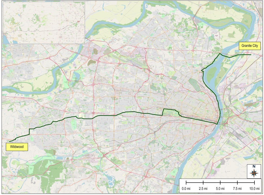

Today was a day loaded with contrast. When I started out just after 6:30 AM, it was cloudy and threatening rain; by the time I finished, the weather was sunny and hot. When I rode the riverfront bike trail into and through St. Louis, I mostly rode past old industrial buildings (some falling down and abandoned) and heavy rail and truck yards; by the time I left St Louis County to the west, I was riding past huge mansions, gated communities, expensive shops, and wealth. Finally, riding atop the levee on the west bank of the Mississippi early in the morning was flat and fast; by the end of the day, I was in the energy-sapping ups and downs of one small hill climb after another. When I finally pulled up to the Wildwood Hotel at 4 PM, I was knackered and played out.
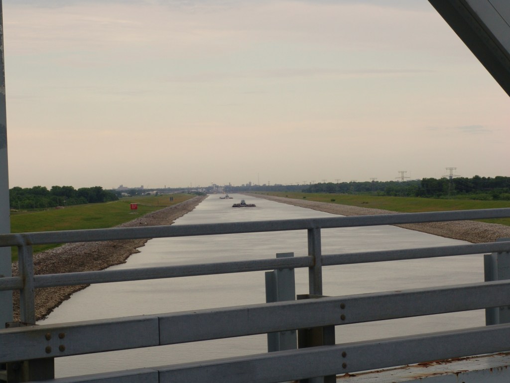
All that aside, the early part of today’s ride was pretty interesting. Almost immediately after leaving the Econolodge in Granite City, I was pedaling on the bridge over the shipping canal behind Carondelet Island. I remember paddling down this canal to the final lock on the river with my sister, Cherrie, twenty years ago. Back then it was a long paddle. Straight, slow, and boring. It didn’t look much different today.
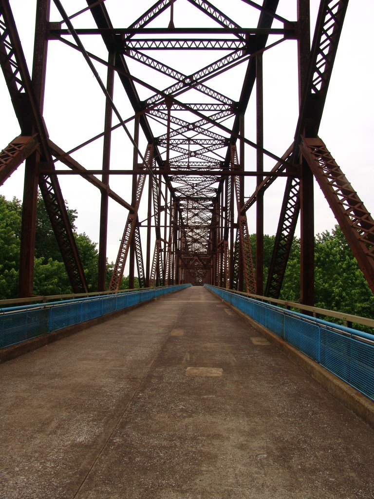
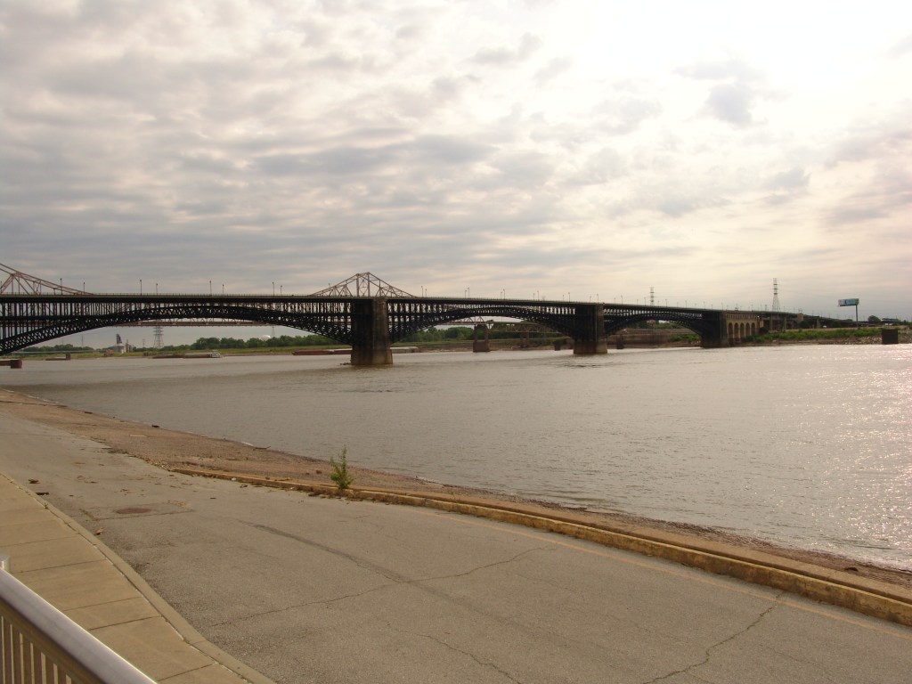
I rode across Carondelet Island to the east entrance of the Chain of Rocks Bridge. The bridge carried Route 66 traffic from 1929 to 1966, when it was closed. One of the more interesting bridges I’ve encountered, The Chain of Rocks Bridge makes a 22-degree turn in the middle of the river. Since the bridge deck is only 22 feet wide the turn in the middle made it difficult for longer trucks to use it without crossing the centerline at that point. Today it’s managed by the National Parks Service and used exclusively for bike and pedestrian traffic to cross the river.
When I pedaled up to the entrance of the Bridge shortly before 7 AM, the gate was closed and locked. Ugh. There was no number to call for entry, no sign detailing the hours the gate is opened. Just the locked gate and me. And I needed to get across that bridge! So I decided to wait on a nearby bench and see if anyone from the NPS would show up. Otherwise, it would be a long ride back to Highway 3 for a ride south to whatever other bridge I might be able to safely ride across the River.
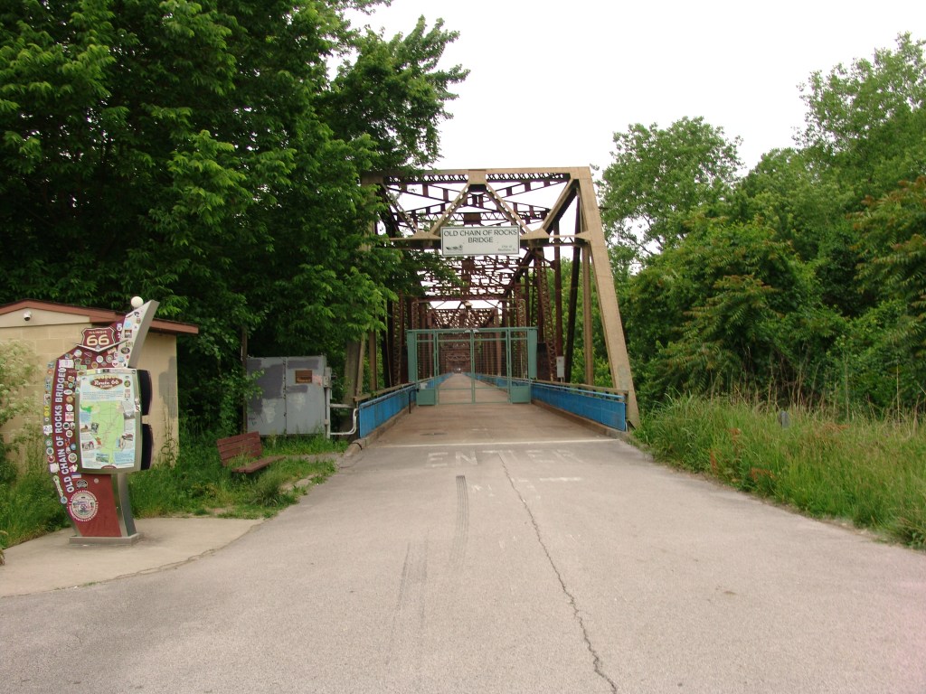
I pulled out my map notes to see if there was any info that could help, when I looked up and … lo and behold … the gate was open! So, either there was an attendant somewhere who spotted me on a camera, or the gate was on a timer to open at 7 AM. And I didn’t care, to be honest. I just started cycling across and hoped the gate on the west side would be unlocked when I reached it. It was.
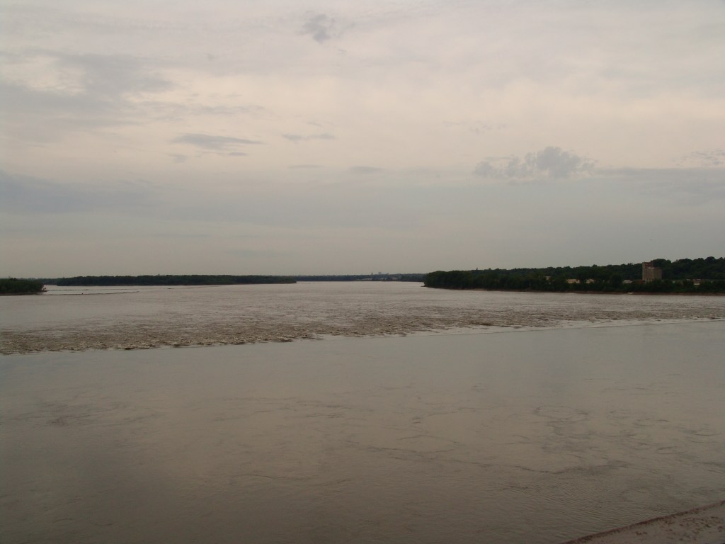
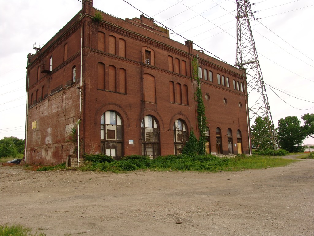
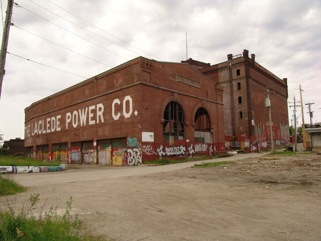
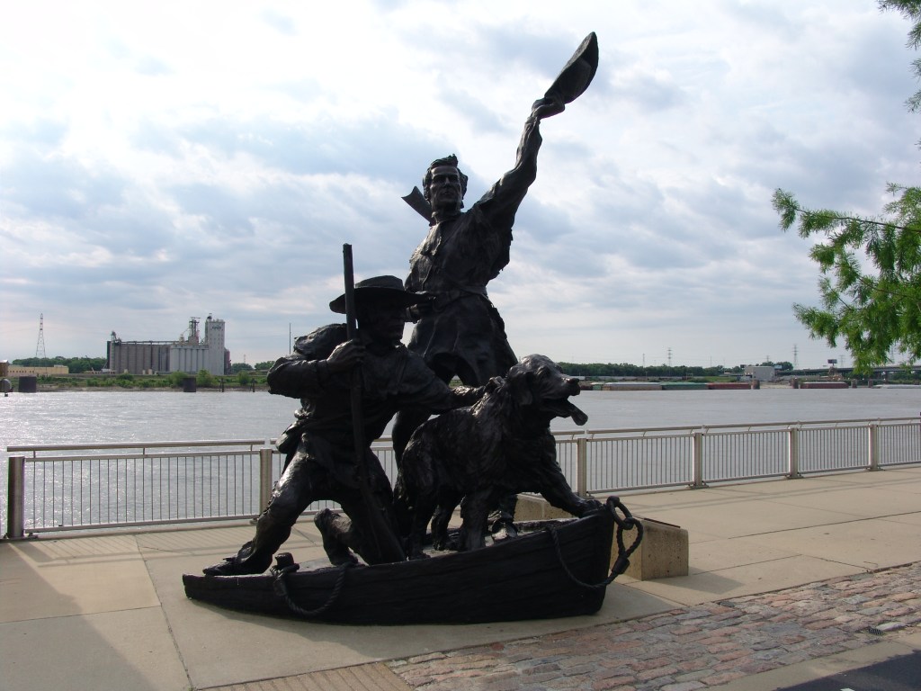
Then I began my ride on the Riverfront Trail to the Arch. Most of the ride was atop the levee or along the sea wall with vacant, wild, and unusable flood land to the left and heavy old industry to the right. Reaching the downtown area, I stopped under the Eads Bridge to see if the statue of Lewis, Clark, and their dog, Seaman, was still there. I have an old photo of me standing next to the statue knee deep in the river holding Clyde, the beagle that accompanied me on my canoe trips down the River in 2007. To my surprise the statue was no longer there! And the entire riverfront under the Arch had changed! New walkways. New, less obtrusive sea walls, Just much more people-friendly features. And a new bronze stature of Lewis, Clark, and Seaman!
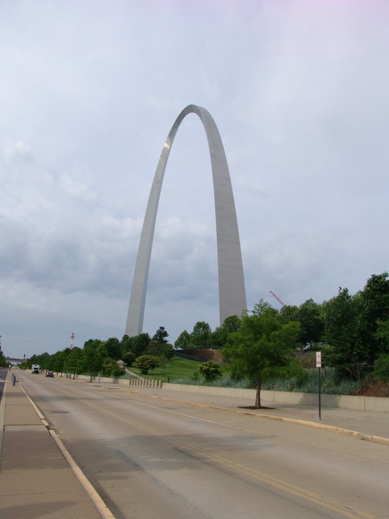
Just south of the Arch I turned west for my ride through the city. Passed St. Louis University and into Forest Park where I stopped for a mid-morning break. Then onto Clayton Road for my long ride through the rich suburbs of Ladue, Creve Cour, and West County communities. Sometimes there was a usable bike lane; often there wasn’t. Sometimes I rode in the increasingly heavy Friday afternoon traffic, sometimes I rode the sidewalks instead. Anyway, I rode Clayton Road for the rest of the afternoon. The afternoon’s heat, hills, and hours I had already pedaled began to take their toll. By now I was walking my bike uphill, riding it downhill. A return to the old-man-strategy I used on my first bike tour to Yellowstone a few years ago.
Tomorrow’s planned ride is 41 miles to a campground near Stanton. There are some pretty good climbs along the way, so I see me doing that “walk uphill, ride downhill” tactic quite a bit more before the day’s done.

Leave a comment